24.04.2026
Researchers at the Leibniz Centre for Agricultural Landscape Research (ZALF), in collaboration with partner institutions, have shown that radar satellites, specifically European Space Agency's (ESA) Sentinel-1 mission, can be used to reliably determine the growth phases of maize and wheat in Germany –independent of weather conditions.
The study, led by ZALF, was published in the journal GIScience & Remote Sensing and provides new insights for sustainable and data-driven agriculture of the future.
Radar signals and plant growth
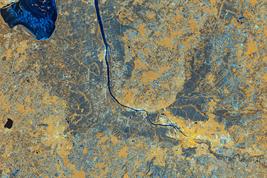
The phenometric analysis made in this study on winter wheat and maize, is based on the open access multi-temporal dataset of European Space Agency's (ESA) Sentinel-1 satellite, and is an active microwave system that records its own emitted signal, which makes acquisition possible throughout the entire season, regardless of weather or time of day.
The radar backscatter showed changes systematically as crop canopy structure and moisture conditions develop. The team examined the seasonal progression of the backscatter and showed that distinct growth stages, such as stem elongation, heading, and flowering in cereals can be detected reproducibly in both wheat and maize. These findings confirm that Sentinel-1 data contain sufficient phenological information to map major development phases at regional scale.
How well does this work – and how else can it be done?
Until now, these growth stages were typically recorded through manual field observations, which are labor-intensive, or estimated from optical satellite data using band-based vegetation indices such as NDVI. However, optical systems frequently contain long data gaps during cloudy periods because rely on sunlight.
The big advantage of the method is that Sentinel-1 provides collection of data every six days in the analyzed period– regardless of clouds or light. For most development stages, the results agreed well with both reference datasets, with average deviations of only a few days. Mid-season phases showed the strongest correspondence, while early development stages were more variable.
The results were compare with phenometrics obtained by the Copernicus High-Resolution Vegetation Phenology and Productivity (HR-VPP) product based on optical data and the data collected for German Weather Service (DWD) on local ground based observations. The study showed that the phenometrics obtained based on Sentinel-1 data provides comparable values and, in some phases, even better resolution.
Such information could help agriculture to plan better:
- Farmers could fertilize or irrigate in a more targeted manner,
- advisory services could predict seasonal developments more accurately,
- politicians and administrators would have up-to-date data on the vegetation status of entire regions,
- and research could better model growth processes.
Because Sentinel-1 data are freely available through the Copernicus Programme, the approach can be applied broadly and adapted to other crops. For more information and access to the data via https://dataspace.copernicus.eu/
Conclusion and outlook
The study led by ZALF shows that radar satellites such as Sentinel-1 are a powerful tool for observing agriculture objectively and comprehensively, regardless of weather conditions. In this way, they contribute to digitalization, climate adaptation, and resource conservation in agriculture.
Project partners
- Leibniz Centre for Agricultural Landscape Research (ZALF), Müncheberg
- University of Potsdam
- Humboldt University of Berlin
- University of Concepción, Chile
- National Open and Distance University (UNAD), Colombia
Further Information:
https://doi.org/10.1080/15481603.2025.2531593
Note on the text:
This is a summary of the original text created with the help of artificial intelligence:
Flores, L., Nendel, C., Bookhagen, B., Oviedo Reyes, J. A., Smith, T., & Ghazaryan, G. (2025). The potential of Sentinel-1 time series for large-scale assessment of maize and wheat phenology across Germany. GIScience & Remote Sensing, 62(1), 2531593. DOI: https://doi.org/10.1080/15481603.2025.2531593,
published open access under the CC BY 4.0 license https://creativecommons.org/licenses/by/4.0/.
The text has been carefully reviewed and revised in accordance with the AI regulations at ZALF.
Funding information:
This project was supported by the German Federal Ministry of Education and Research (BMFTR) under grant number 16DKWN089, the HORIZON EUROPE SWITCH project under grant number 101060483, and the DFG project STRIVE under grant number SM 710/2-1.

