Press Release
DFG project launches at ZALF: Hydrology Research meets Biodiversity Research
Is grassland with high levels of biodiversity more resistant to adverse environmental changes such as drought? Scientists from the Leibniz Centre for Agricultural Landscape Research (ZALF) want to investigate this hypothesis using remote-controlled drones. For this purpose, the DFG project “pETchy: Patterns of Evapotranspiration Changing throughout the Year” is launched on 1 March 2017 as part of the DFG “Biodiversity Exploratories” priority programme.
The researchers at the Institute of Landscape Hydrology and at the Institute of Soil Landscape Research at ZALF have three years to examine a frequently postulated positive effect of high levels of biodiversity. The concept of the use of complementary ecological niches states that plant stands with high levels of biodiversity can better adapt to non-favourable environmental conditions such as less rainfall, by compensating through better adapted or less demanding species. Theoretical considerations already exist and preliminary work has been done, however there is a lack of valid data from grassland.
Drones will now continually fly over and photograph numerous study sites throughout the whole of Germany over a given period of time. The “pilot” on the ground is qualified hydrologist Philipp Rauneker, a PhD student at the Institute of Landscape Hydrology: “As a first step, we apply for permissions from the competent authorities to fly over the sites. Then flight plans are being drawn up. The drones will then fly automatically along the planned routes via GPS. I therefore only need to intervene in the event of an emergency.” The drones, which are also known as “UAVs”, or “unmanned aerial vehicles”, are specially designed for the research flights and equipped with thermal and multi-spectral cameras. The thermal sensors measure the temperature of the surface. Low temperatures are an indication of a high evaporation rate, because the process extracts heat from the environment. The spectral camera determines the leaf area index, which is the leaf area per square metre of grassland. Valid information about the evaporation levels can be derived from the combination of these two data sets. Thus particularly “robust” and resistant areas can be detected. In addition, soil samples are taken and analysed to include the effects of soil properties, because water absorption capacity differs significantly, for example, between clay and sandy soils.
Philipp Rauneker and his team then evaluate the data together using special software. The scientists already have a suspicion: The effects of biodiversity can be already seen in the evaporation patterns. Statements about these relationships are of particular interest for agriculture.
The funds for the financing of a subproject have been made available as part of the 2017-2020 funding phase of the DFG priority programme 1374.
 Press Release as PDF
Pictures
For downloading the pictures please click on a picture and use the
 icon.
icon.
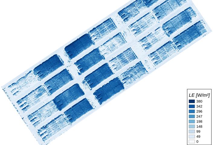
Caption: A sample image for determining evaporation levels above agricultural land. Dark blue indicates areas with greater evaporation. | Source: © ZALF
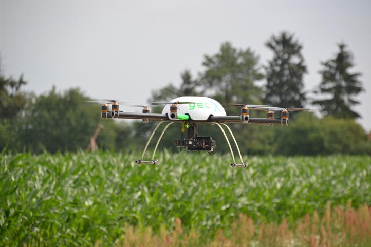
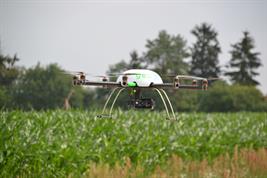
Caption: Drones will continually fly over and photograph 150 study sites throughout the whole of Germany within a given period of time. | Source: © Philipp Rauneker / ZALF

